June 24-30, 2010 – Gunnison, CO

Blue Mesa Reservoir is in the Curecanti National Recreation Area. It is 20 miles long and the largest reservoir in Colorado. While we are here we are going to see the Black Canyon of the Gunnison National Park and take some 4WD drives into the beautiful mountains of the western slope of Colorado.
Black Canyon of the Gunnison National Park
.JPG)
We spent a day at the north rim of the Black Canyon of the Gunnison National Park. We drove the South Rim Road and stopped at all the overlooks. This is Rex’s first visit to this park and he was amazed at how beautiful and rugged it is. Nancy was here before it was a National Park (about 27 years ago) and was glad to see many improvements in the facilities.
.JPG)
.JPG)
.JPG)
.JPG)
.JPG)
This part of the canyon is not as deep as in the National Park but it was still beautiful. During the cruise a Park Ranger told us about the geology, wildlife, early inhabitants, the narrow-gauge railroad, dams and reservoirs of the area.
.JPG)
.JPG)
.JPG)
The pointed rock formation in the center was used in the Denver & Rio Grande Railroad logo.
.JPG)
After we climbed those 232 steps back up to the parking lot we drove to the North Rim of the Black Canyon of the Gunnison National Park. Along the way we stopped at some overlooks above the narrow Marrow Point Reservoir and could see the Curecata II on its next cruise.
.JPG)
.JPG)
The North Rim of the Black Canyon of the Gunnison National Park is less developed. The roads are unpaved and there is only a Ranger Station and no Visitor Center. We thought the views from the overlooks on this side were more spectacular than on the South Rim.
.JPG)
As Rex was going to the edge to take this picture he tripped and almost went over. He now has a much greater respect for railings.
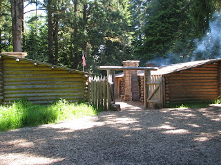
Alpine Tunnel 4WD Drive
.JPG)
.JPG)
.JPG)
To the left of the station are the remains of a large stone engine house that had burned down. The engine house also had a turntable in it and, after it burned, the railroad built this turntable between the station and the tunnel.
.JPG)
This is all that is left of the tunnel on this side as it has been sealed - we assume for safety purposes.
Alpine Loop Backcountry Byway
The Alpine Loop Backcountry Byway is a 65 mile road through the San Juan Mountains connecting Lake City, Ouray and Silverton. First we had to drive Highway 149 for 50 miles from Blue Mesa Reservoir to Lake City. After a stop at the Visitor Center in Lake City and purchasing an Alpine Loop guide we headed toward Cinnamon Pass. Three years ago we took this trip in reverse with a commercial tour company on a year-end trip with members of the Rascals camping group. We were anxious to see how we would do on our own.
.JPG)
.JPG)
We made it to the top of 12,620’ Cinnamon Pass! This is our first pass over 12,000’ driving our Jeep – a piece of cake!

.JPG)
.JPG)
After eating lunch at Animas Forks (in the Jeep as it was windy, raining and cold) we headed up Engineer Pass toward Gunnison. You can also go south to Silverton or North to Ouray from here. This is a great view of the San Juan Mountains on the way up.
.JPG)
Going up this side of Engineer Pass was really steep and challenging but we made this one too! Engineer Pass is 12,800’.
.JPG)

About this time it started snowing and snowed for about 15 minutes and then rained. We were glad we were farther down the pass when it started snowing. We made it back to Lake City and then the long 50 mile drive back to our RV park. What a great day! No matter where we travel to we know we will always come back to the beautiful mountains of Colorado.
West Elk Loop Scenic and Historical Byway
Our last day in this area was spent driving the West Elk Loop Scenic and Historical Byway. This loop circumnavigates the West Elk Mountains. We started in Gunnison and drove to Crested Butte where we stopped at the Visitor Center. From Crested Butte we headed up Kebler Pass. The road follows the old Rio Grande Railroad grade and passes by the old mining camps of Irwin and Ruby, the lumber camp of Telco and the coal mining town of Floresta. The only evidence we found of any of these places was the Irwin Cemetery on top of Kebler Pass. We walked around the cemetery and found a few grave sites.
.JPG)

The road travels through one of the largest contiguous aspen stands in the world. We must have driven for 5 miles through this aspen stand. It was beautiful to be surrounded by all the magnificent trees. We imagine it must be spectacular in the fall.

We then found ourselves in the North Fork of the Gunnison River valley. We didn’t realize this area has fruit orchards and wineries. Of course, we had to stop and get some fresh picked cherries and some local wine. We had a picnic lunch on the grounds of the Black Bridge Winery which is on the North Fork of the Gunnison outside of Paonia. What a beautiful picnic spot!
This area also has several active coal mines. We finished the drive by going through Hotchkiss and Crawford and passing by the North Rim of the Black Canyon of the Gunnison.
We had a very nice week here and could stay and do a lot more 4 wheeling but tomorrow we are moving on to Chama, NM where Rex will spend a month volunteering on the Cumbres/Toltec Scenic Railroad.
.JPG)

Comments
Post a Comment