June 1- 5, 2010 Capitol Reef National Park
We arrived at Torrey, UT and are staying at the Sand Creek RV Park, which is about 5 miles from Capitol Reef National Park.
We took the10 mile scenic drive south into the park – another one of our nation’s treasures.
.JPG)
.JPG)
.JPG) At the end of the scenic road we hiked into Capitol Gorge.
At the end of the scenic road we hiked into Capitol Gorge.
.JPG) A short distance into the gorge we came upon these petroglyphs.
A short distance into the gorge we came upon these petroglyphs.
 Further along the gorge we hiked up the canyon wall to “The Tanks” which are large waterpockets that are eroded into the sandstone. These waterpockets catch and hold rainwater and snowmelt and serve as water sources for many animals. We were able to see 4 of these tanks but only two had water in them.
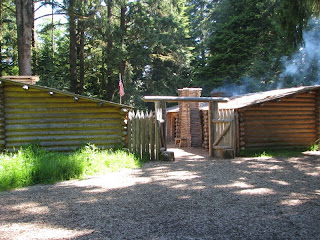
At the Visitors Center is the site of an old Mormon town called Fruita. There are still lots of fruit trees in the park and visitors are allowed to pick fruit in season. We stopped at a country store/museum and bought some fresh pies and scones – Mmmm good.
From the Visitors Center we headed east through the park. Along the highway was a wall of petroglyphs.
.JPG)
.JPG) Capitol Reef National Park got its name from this rounded Navajo sandstone formation called “Capitol Dome” which resembles the nation’s capitol building. The Reef part of the name refers to the nearly impassable cliffs and ridges, reminiscent of impassable ocean reefs.
Capitol Reef National Park got its name from this rounded Navajo sandstone formation called “Capitol Dome” which resembles the nation’s capitol building. The Reef part of the name refers to the nearly impassable cliffs and ridges, reminiscent of impassable ocean reefs.
 On Thursday we took a day long drive called “Loop-the-Fold” which follows the Waterpocket Fold formation – a geological wonderland crowned with immense sandstone domes and cut deep with slot canyons. This drive took us through Capitol Reef National Park, Grand Staircase-Escalante National Monument and Dixie National Forest.
.JPG) We stopped and hiked into one of the slot canyons called Surprise Canyon. This canyon had more vegetation in it than the other canyons we have hiked.
We stopped and hiked into one of the slot canyons called Surprise Canyon. This canyon had more vegetation in it than the other canyons we have hiked.
.JPG)
We think we found the surprise in this canyon – a very high rock wall that we could not climb over.
.JPG)
.JPG) After our hike we turned on to the Burr Trail Road and immediately had to climb the Burr Trail Switchbacks which climb 800 ft in ½ mile – glad we are driving and not hiking! John Burr developed the Burr Trail for moving sheep between summer grazing at the Circle Cliffs and the winter range at Halls Creek. He opened a rough way through the previously impenetrable barrier by carving a series of steep and narrow switchbacks across the face of the Waterpocket Fold. The switchbacks were improved for vehicle use during uranium mining prospecting in the 1950s and ‘60s.
After our hike we turned on to the Burr Trail Road and immediately had to climb the Burr Trail Switchbacks which climb 800 ft in ½ mile – glad we are driving and not hiking! John Burr developed the Burr Trail for moving sheep between summer grazing at the Circle Cliffs and the winter range at Halls Creek. He opened a rough way through the previously impenetrable barrier by carving a series of steep and narrow switchbacks across the face of the Waterpocket Fold. The switchbacks were improved for vehicle use during uranium mining prospecting in the 1950s and ‘60s.
We stopped at the Strike Valley Overlook
.JPG)
.JPG)
The Burr Trail ends at its junction with Utah Highway 12 at the small mountain town of Boulder. We then headed down Highway 12 over Boulder Mountain back to Torrey.
.JPG) Friday we hiked to a couple of arches. We first drove into the park to Grand Wash and hiked into the Cassidy Arch. This arch is named for the outlaw Butch Cassidy who supposedly had a hideout in Grand Wash. We hiked down the wash for a quarter mile.
Friday we hiked to a couple of arches. We first drove into the park to Grand Wash and hiked into the Cassidy Arch. This arch is named for the outlaw Butch Cassidy who supposedly had a hideout in Grand Wash. We hiked down the wash for a quarter mile.
.JPG) We then had a very steep 900 ft climb out of the canyon. It’s a long way down to the parking lot and we are still not at the top!
We then had a very steep 900 ft climb out of the canyon. It’s a long way down to the parking lot and we are still not at the top!
.JPG) We had a long hike along the canyon rim to get to the arch.
We had a long hike along the canyon rim to get to the arch.
.JPG) We were not able to get to the base of the arch.
We were not able to get to the base of the arch.
.JPG) But did hike to the top of it.
But did hike to the top of it.
.JPG)
.JPG) We were able to hike up to Hickman Natural Bridge and had lunch under it.
We were able to hike up to Hickman Natural Bridge and had lunch under it.
.JPG) This is another small set of bridges along the trail.
This is another small set of bridges along the trail.
.JPG) On Saturday we took a drive on a jeep road to Cathedral Valley. We had to ford the Fremont River to get started.
On Saturday we took a drive on a jeep road to Cathedral Valley. We had to ford the Fremont River to get started.
.JPG) We stopped for a local pedestrian to cross the road – a gopher snake. We also had to avoid lots of lizards crossing the road.
We stopped for a local pedestrian to cross the road – a gopher snake. We also had to avoid lots of lizards crossing the road.
.JPG) We stopped at the Upper South Desert Overlook and got a great view – pretty desolate country.
We stopped at the Upper South Desert Overlook and got a great view – pretty desolate country.
.JPG) We finally arrived at Cathedral Valley
We finally arrived at Cathedral Valley
.JPG) You can see how it got its name. These are called The Monoliths but they look like cathedrals.
You can see how it got its name. These are called The Monoliths but they look like cathedrals.
.JPG) We also stopped at Gypsum Sink Hole – it was at least 100 feet deep!
We also stopped at Gypsum Sink Hole – it was at least 100 feet deep!
 Our last stop on this drive was at the Temple of the Sun (largest) and the Temple of the Moon.
It was really hot today and made for a long, tiring but enjoyable day.
We really enjoyed Capitol Reef National Park and the surrounding area.
We took the10 mile scenic drive south into the park – another one of our nation’s treasures.
.JPG)
.JPG)
.JPG)
.JPG)

At the Visitors Center is the site of an old Mormon town called Fruita. There are still lots of fruit trees in the park and visitors are allowed to pick fruit in season. We stopped at a country store/museum and bought some fresh pies and scones – Mmmm good.
From the Visitors Center we headed east through the park. Along the highway was a wall of petroglyphs.
.JPG)
.JPG) Capitol Reef National Park got its name from this rounded Navajo sandstone formation called “Capitol Dome” which resembles the nation’s capitol building. The Reef part of the name refers to the nearly impassable cliffs and ridges, reminiscent of impassable ocean reefs.
Capitol Reef National Park got its name from this rounded Navajo sandstone formation called “Capitol Dome” which resembles the nation’s capitol building. The Reef part of the name refers to the nearly impassable cliffs and ridges, reminiscent of impassable ocean reefs.
.JPG)
.JPG)
We think we found the surprise in this canyon – a very high rock wall that we could not climb over.
.JPG)
.JPG)
We stopped at the Strike Valley Overlook
.JPG)
.JPG)
The Burr Trail ends at its junction with Utah Highway 12 at the small mountain town of Boulder. We then headed down Highway 12 over Boulder Mountain back to Torrey.
.JPG)
.JPG)
.JPG)
.JPG)
.JPG)
After we finished hiking to the Cassidy Arch we drove to the east side of the park and hiked to the Hickman Natural Bridge. We hiked a short distance along the Fremont River before climbing up to the bridge.
.JPG)
.JPG) We were able to hike up to Hickman Natural Bridge and had lunch under it.
We were able to hike up to Hickman Natural Bridge and had lunch under it..JPG) This is another small set of bridges along the trail.
This is another small set of bridges along the trail..JPG) On Saturday we took a drive on a jeep road to Cathedral Valley. We had to ford the Fremont River to get started.
On Saturday we took a drive on a jeep road to Cathedral Valley. We had to ford the Fremont River to get started..JPG)
.JPG)
.JPG)
.JPG)
.JPG)

It was really hot today and made for a long, tiring but enjoyable day.
We really enjoyed Capitol Reef National Park and the surrounding area.
.JPG)

Comments
Post a Comment