Posts

Showing posts from July, 2011

July 27-30, Lassen Volcanic National Park, CA

Image
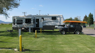
We left Tulelake on Wednesday morning and headed south towards Lassen Volcanic National Park.  Now that we are in California we can tow the Jeep behind the 5 th wheel – it is nice to travel in the same vehicle again!  We drove by 14,162 ft. Mt. Shasta – another of our beautiful mountains.  Mt. Shasta has 5 glaciers and its most recent eruption occurred in 1786. We stopped at McArthur-Burney Falls Memorial State Park to see Burney Falls.  The Falls cascades 129 ft. over a cliff into a pool that is 22 ft. deep.  We ate lunch here and hiked down to the base of the waterfall.  Another spectacular falls – we have seen so many beautiful waterfalls this trip that we can’t pick our favorite! Our campground is on the other side of Lassen Volcanic National Park so we drove through the park.  The ranger at the entrance station suggested that we unhitch the Jeep and drive it separately as the road is very curvy.  The 29 mile road starts at the northwest entrance (5,808 ft) and climbs to

July 25-26, 2011 – Lava Beds National Monument, Tulelake, CA

Image
Monday morning, July 25 th , we left Prospect, OR and headed south towards California.  We stopped just across the state line at Tulelake, CA and are camped at the Tulelake Butte Valley Fair Grounds.  We have a very nice site on the grass and under a great shade tree.  The sites are narrow but there are currently only two rigs here so we can spread out.  Now that we are no longer in Oregon, Rex is going to miss having someone else pump our gas.  In Oregon it is against the law to pump your own gas and Rex enjoyed letting someone else do the pumping.  Camille and Cody enjoying the grass and shade. Tuesday we drove to Lava Beds National Monument just south of Tulelake.  Lava Bed National Monument lies on the northern flank of the massive Medicine Lake volcano.  Medicine Lake is a shield volcano and last erupted about 1,100 years ago. We stopped at Petroglyph Point where there are hundreds of petroglyphs and pictographs along a cliff. Mammoth Crater, within Me

July 21-24, 2011 – Upper Rogue River and Crater Lake National Park (continued)

Image
Thursday morning we hiked a short trail along the Upper Rogue River to Pearsony Falls. We then hiked to the Avenue of Giant Boulders, created the same time as Crater Lake, 7,700 years ago.  When the volcano erupted it blew huge, room sized boulders some 20 miles and deposited them here along the Upper Rogue River. We enjoyed hiking among these huge boulders. We did another hike along the Upper Rogue River to two beautiful waterfalls.  The first was Mill Creek Falls. Just down the trail a short distance was even more spectacular Barr Creek Falls. We enjoyed these hikes and it was good to get the dogs out on a trail again.  After our hikes we took a short drive to Flounce Rock, a viewpoint where you can see the Pacific Coast Range and Mount Shasta. We also got a great view of Lost Creek Reservoir. We ate a picnic lunch here and enjoyed the beautiful wildflowers. When we got back to the RV Park later in the afternoon, Rex