August 13-19, 2012 – Coalville, UT Area
 We left Hot Springs Park and headed south to
Coalville, UT, which is in the mountains east of Salt Lake City. It is cooler here and we are glad we do not
have to use the air conditioner. We are
staying at Echo Island Park, another Camperworld membership park.
We left Hot Springs Park and headed south to
Coalville, UT, which is in the mountains east of Salt Lake City. It is cooler here and we are glad we do not
have to use the air conditioner. We are
staying at Echo Island Park, another Camperworld membership park.
This is a nice park with the Weber River running through it. The River splits and forms a small island in
the middle of the park – thus the name Echo Island. All of the sites are grassy and most of them
are shaded.


We saw some places where the emigrants on the California and Mormon Trails camped and sites of Pony Express Stations. Brigham Young, who was seriously ill, and his party camped below this formation called Sentinel Rock. Members of Young’s party climbed to the top of the hills behind Sentinel Rock to pray for him.

After we left Echo Canyon we traveled a short distance on
the Weber Canyon Route-Hasting Cutoff to view a rock formation called Devil’s
Slide – a pretty impressive formation.

I-84
is now beside this formation but in 1846 there was no room for a wagon road
through the narrows; the canyon floor was a frothing, boulder choked stream
channel edged by cliffs and steep talus.
Despite the obvious danger, two wagon companies tried to pass through
Weber Canyon. The larger train lost a
wagon and a yoke of oxen.

We
continued our tour of the Hastings Cutoff a few days later. The Trails turns into Main Canyon outside of
Henefer, UT and then into East Canyon.
There was a pull off where you could walk out to the original trail – we
were surprised that you could still see the wagon ruts.
We stopped at a couple of other places where you can see the
wagon ruts and where the emigrants camped by springs.

Mormon Flats is now a state operated group campground where you can hike on the actual trail.

We hiked a short distance to where the Mormon militia built
more stone breastworks on either side of the creek. Here we could easily see the militia
fortifications and were able to hike up the hill to get a closer look.

The
trails travel up Emigrant Canyon from Mormon Flats toward Big Mountain
Pass. At Big Mountain Pass the emigrants
got their first look at the Valley of the Great Salt Lake. Unfortunately, because of smoke from fires in
Utah, Idaho, Washington and Oregon, we couldn’t see very far – still an
impressive view.

Reaching
the valley was very dangerous for the pioneers.
The wagons, with high centers of gravity, could not switchback down for
fear of toppling over. Also, oxen could
not balance nor wagons brake effectively when traveling “sidling” along a
hill. Most emigrants locked their wheels
with chains and skidded their wagons straight down the mountainside. You can still see the skid marks going
straight down.

We
drove down the highway which, thankfully, does switchback down the mountain and
stopped where the trail crosses the highway.
We cannot imagine skidding a wagon down this steep slope.

Little Mountain posed another steep climb for weary
travelers and livestock. Here emigrants
had to double and triple team their oxen for the ascent, then lock their wheels
to skid down the other side. The white
marker on the downhill side marks where the original trail was located.
It is hard to imagine sitting in our modern vehicles how the
emigrants managed to travel all this way by walking, covered wagon, and hand
carts. The Mormon Trail stops at Salt
Lake City but the California Trail and the Pony Express Trail continue on
across Nevada.

At the bottom of Emigrant Canyon we stopped at the This Is
The Place Heritage Park which commemorates the arrival of Mormon pioneers in the
Valley of the Great Salt Lake. Mormon
tradition holds that when Brigham Young first gazed on the valley from this
vicinity on July 25, 1847, he experienced a heavenly vision that led him to
declare, “It is enough. This is the
right place.”

The
area in front of the visitor’s center had concrete “wagon ruts”.

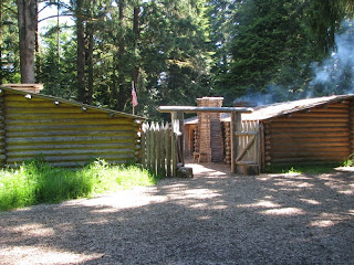
The
park includes a Heritage Village with original pioneer-era buildings that were
moved here from around the state. Some
of the buildings had docents and historical interpreters who shared history and
demonstrated early crafts and trades.
The ladies at this house were spinning wool and weaving.

In
the fenced yard around this house was a miniature pony colt named Lilly and her
mom. Here one of the docents is playing
with Lilly.

The
park had an impressive display of hand carts.
It is hard to imagine putting all your belongings in a cart like this
and pulling it from Nauvoo, Illinois to Salt Lake City – over 1260 miles.

We stopped at the Blacksmith Shop and talked to the two
gentlemen who showed us the kind of things they make. They did all kinds of iron work – hooks,
nails, tools, chandeliers – but they did not make horseshoes or shoe horses.

We also stopped at the Deseret News Print Shop where a
printer and his helper were cleaning the press.
The printer apologized that he could not show us how the printer worked
as they had to wait until the cleaning solvent dried before they could
print. He did explain how the press
worked and gave us a copy of the June 15, 1850, Vol. 1, No. 1 issue of the newspaper
that he had printed on the printer the day before.

The
National Pony Express Monument is at the entrance to the park. The sculpture of a relay rider changing
horses by Avard Fairbanks was beautiful.
We
really enjoyed our stay in this area and the auto tour of the California,
Mormon Pioneer and Pony Express Trails.
We learned a lot about these trails and the difficulties the emigrants
faced on their trek west.
.JPG)

Comments
Post a Comment