May 11-15, 2010 – Lake Powell
We woke up Tuesday morning to cold wind and snow flurries and headed out for Page, AZ and Lake Powell. We hit more snow flurries about 50 miles South of Page. On the way we drove alongside Echo Cliffs for a long way and then crossed through them.
.JPG)

We are staying on the shores of Lake Powell in Wahweap Campground in the Glen Canyon Recreational Area - we have a great view of the lake from our back window. The campground is in Arizona but the north end of the campground borders the Utah state line. It was really windy here all afternoon and we got a few more snow flurries.

.JPG)
.JPG)
.JPG)
After a brief look at the back side of Glen Canyon Dam, we entered Antelope Canyon. What an awesome canyon, very narrow with steep cliffs on both sides. The canyon kept getting narrower the farther in we went. The colors on the canyon walls were incredible. The captain took the boat back far enough into the canyon we thought we were going to have to back out; but he was able to turn the boat around in the very small space with the aid of side thrusters. Tomorrow we plan to hike in Antelope Canyon above the lake.
.JPG)
.JPG)
.JPG)
.JPG)
.JPG)
.JPG)
.JPG)
.JPG)
.JPG)
We took an elevator down 11 stories and walked along the top of the dam to the next elevator which took us 58 stories down into the bottom of the dam. We were able to view the 8 turbine generators used to generate electricity.

.JPG)
.JPG)
.JPG)
.JPG)
.JPG)
.JPG)
.JPG)
.JPG)
.JPG)
.JPG)
.JPG)
After lunch we drove a couple of miles downstream from the dam to the Horseshoe Bend Overlook. This is a spectacular overlook where you look down 1,000 feet into the Colorado River as it makes a horseshoe bend.
.JPG)
.JPG)
.JPG)
We ran across this Western Whiptail Lizard on our hike back to the parking area.

Friday morning we woke up to rain and it rained most of the morning. We were glad to see it stop as we were going on a cruise to Rainbow Bridge at noon. About halfway through the cruise the sun came out and it was a beautiful afternoon.
Our cruise to Rainbow Bridge, on the Canyon Explorer, was 50 water miles each way and lasted 6 hours. We got to see a lot more of the lake – but this is a big lake! Lake Powell is 186 miles long and has 1,960 miles of shoreline – more than the whole western coast of the continental United States. It has more than 96 major side canyons.
.JPG)
.JPG)
.JPG)
.JPG)
.JPG)
.JPG)
Saturday we drove about 25 miles downstream from Lake Powell to Lees Ferry. On the way we stopped at Navajo Bridge over the Colorado River. The view was beautiful from the bridge and we saw a couple of California Condors flying through the canyon.
.JPG)
Lees Ferry lies in the break between Glen, Marble, and Paria canyons and was the only place a wagon road could be built to connect Utah and northeastern Arizona. Lees Ferry was settled by John D. Lee, who established the first Colorado River crossing here. A stone fort, built in 1874 in anticipation of conflict between the Navajo and settlers, served briefly as a trading post.
.JPG)
.JPG)
.JPG)
.JPG)
We thought these balancing rocks along the road to Lees Ferry were interesting.
.JPG)
.JPG)
.JPG)

We are staying on the shores of Lake Powell in Wahweap Campground in the Glen Canyon Recreational Area - we have a great view of the lake from our back window. The campground is in Arizona but the north end of the campground borders the Utah state line. It was really windy here all afternoon and we got a few more snow flurries.

We woke up Wednesday morning to beautiful weather – no wind. We took a cruise on Lake Powell to Antelope and Navajo Canyons aboard the Desert Shadow.
.JPG)
These rock formations are at the beginning of the cruise as we left Wahweap Marina. The white band from the waterline up is the high water mark, which is approximately 80 feet above the surface. Lake Powell is currently only 56% full.
.JPG)
.JPG)
After a brief look at the back side of Glen Canyon Dam, we entered Antelope Canyon. What an awesome canyon, very narrow with steep cliffs on both sides. The canyon kept getting narrower the farther in we went. The colors on the canyon walls were incredible. The captain took the boat back far enough into the canyon we thought we were going to have to back out; but he was able to turn the boat around in the very small space with the aid of side thrusters. Tomorrow we plan to hike in Antelope Canyon above the lake.
.JPG)
.JPG)
.JPG)
.JPG)
After leaving Antelope Canyon, we headed to Navajo Canyon. Navajo Canyon was not as narrow as Antelope Canyon but did have some beautiful colors. The dark striping is called desert varnish and is caused by manganese oxide and bacterial growth occurring where water runs down over the rock face.
.JPG)
.JPG)
On our way back to Wahweap Marina passed this huge rock formation.
.JPG)
We also went past the Lake Powell Zoo – if you look closely you can see an owl in the far left formation; a turtle in the center formation; and an elephant in the right formation (alcohol might help you see them better).
.JPG)
After lunch we toured the Glen Canyon Dam. Concrete for the arch dam, completed in 1966, was poured around the clock for over three years. The dam’s crest is 1,560 feet long. It lies 710 feet above bedrock and 583 feet above the original river channel. When Lake Powell is full, it is 560 feet deep at the dam.
.JPG)
We took an elevator down 11 stories and walked along the top of the dam to the next elevator which took us 58 stories down into the bottom of the dam. We were able to view the 8 turbine generators used to generate electricity.

On Thursday morning we drove to Antelope Canyon on the Navajo Indian Reservation. You can only go into the canyon with a native guide. Antelope Canyon is two separate slot canyons that drain into Lake Powell – Upper and Lower. Each canyon contains “slots” carved into swirling Navajo Sandstone. We toured the Lower Canyon and entered through a very narrow opening.
.JPG)
Once we got down through this opening we just had to stop and look around in awe. This canyon is so beautiful words can’t describe it. The canyon is narrow with many twists and turns. There were places on the canyon floor that were not wide enough for your foot and other places where it was so narrow you had to bend your body around the rocks. Every time we turned a corner or looked up or back we were treated to another beautiful view. We took 77 pictures in the 45 minutes we were in the canyon and had a hard time picking out a few to show you. We met a very nice couple of Edmonton, Alberta and shared taking pictures of each other.
.JPG)
.JPG)
.JPG)
.JPG)
.JPG)
.JPG)
.JPG)
.JPG)
.JPG)
After lunch we drove a couple of miles downstream from the dam to the Horseshoe Bend Overlook. This is a spectacular overlook where you look down 1,000 feet into the Colorado River as it makes a horseshoe bend.
.JPG)
.JPG)
.JPG)
We ran across this Western Whiptail Lizard on our hike back to the parking area.

Friday morning we woke up to rain and it rained most of the morning. We were glad to see it stop as we were going on a cruise to Rainbow Bridge at noon. About halfway through the cruise the sun came out and it was a beautiful afternoon.
Our cruise to Rainbow Bridge, on the Canyon Explorer, was 50 water miles each way and lasted 6 hours. We got to see a lot more of the lake – but this is a big lake! Lake Powell is 186 miles long and has 1,960 miles of shoreline – more than the whole western coast of the continental United States. It has more than 96 major side canyons.
.JPG)
.JPG)
We turned into narrow Forbidding Canyon to reach the trail head to Rainbow Bridge. This canyon was so narrow you could almost touch both sides from the boat. We hiked about two-thirds of a mile to the bridge.
.JPG)
.JPG)
On our hike back to the boat dock we came across this Desert Spiny Lizard
.JPG)
and this Side-Blotched Lizard among many others.
.JPG)
We had a great time on the cruise and really enjoyed Rainbow Bridge but were tired by the time we got back in the evening.
Saturday we drove about 25 miles downstream from Lake Powell to Lees Ferry. On the way we stopped at Navajo Bridge over the Colorado River. The view was beautiful from the bridge and we saw a couple of California Condors flying through the canyon.
.JPG)
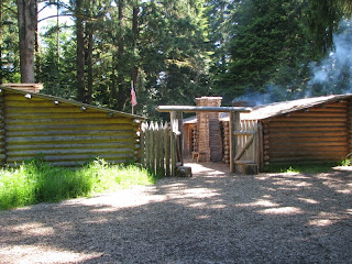
Lees Ferry lies in the break between Glen, Marble, and Paria canyons and was the only place a wagon road could be built to connect Utah and northeastern Arizona. Lees Ferry was settled by John D. Lee, who established the first Colorado River crossing here. A stone fort, built in 1874 in anticipation of conflict between the Navajo and settlers, served briefly as a trading post.
.JPG)
Charles H. Spencer, a gold miner in the area, brought a steamboat here to haul supplies for his mine. The mine failed because the gold in the area was too fine to collect and process. The steamboat was abandoned and sank. You can see what’s left of the boat on the shore of the Colorado River.
.JPG)
Up the canyon from Lees Ferry is the Lonely Dell Ranch, where the families of the ferry men lived. The ranch is in a nice area with lots of trees, a garden and an orchard. The Park Service still maintains the garden and orchard.
.JPG)
.JPG)
We thought these balancing rocks along the road to Lees Ferry were interesting.
.JPG)
.JPG)
We had a great time at Lake Powell and plan to return here again so we can explore more of this vast lake and beautiful area.
.JPG)

Comments
Post a Comment