October 5-6, Big Bend National Park, TX
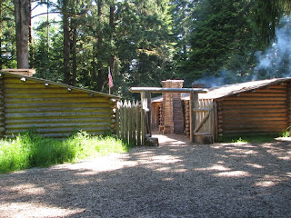
This is the view from our site. Much nicer than the view of the oil well we had in Midland.
Friday morning, we drove into Big Bend National Park. We are excited to see this park for the first
time.
Our first view of the Chisos
Mountains just inside the entrance. They
are beautiful and we didn’t realize south Texas had mountain peaks that reached over
7,000 ft.
The closer we got to the mountains the more
breathtaking the scenery.
We drove down the Ross Maxwell Scenic Drive on the west side of the Chisos Mountains. And stopped at the Sam Nail Ranch site. Sam and Nena Nail dug a well, planted a garden and built holding pens for horses, chickens, and a milk cow.
This old windmill no longer works but another one pumps and keeps the trees and shrubs the Nail’s planted alive.
We stopped at the Lower Burro Mesa Pouroff where we hiked a one-mile trail through a gravel creek bed to a narrow box canyon where water has carved a deep channel into Burro Mesa. A pouroff is a seasonal waterfall and this one is 100 ft tall.
It was cool enough this morning that we could leave
Tacky in the Jeep while we took this short hike. The canyon walls along the trail were
beautiful.
Our next stop was a line camp on the Homer Wilson Ranch which was abandoned in 1945. Homer Wilson ran 4,000 sheep and 2,500 goats on his ranch.
We hiked a short trail down into the canyon to look at the foreman’s house. The house made use of native materials: reed ceiling from the river, timbers from the mountains, and large stones from Blue Creek Canyon. The floor was beautiful. Nearby are the ruins of a bunkhouse, a circular corral, and a dipping vat for sheep and goats.
We stopped at Mule Ears Viewpoint to get a view of Mule
Ears Peaks.
We stopped at Castolon Visitor Center
which was closed for the summer. We had
a picnic lunch at the covered picnic tables and walked around the grounds
looking at some of the historical displays.
Cerro Castellan or Castolon Peak. The layers reveal millions of years of
volcanic events.
More rock formations that we liked.
We also liked this small arch.
The Ross Maxwell Scenic Drive ends at the beautiful
Santa Elena Canyon. We took a short walk
down to the river and the mouth of the canyon.
There is a hike back into the canyon, but we had Tacky with us and it
was too warm to leave him in the Jeep.
We drove back to the Maverick Entrance Station on the
Old Maverick Road, a rough gravel road that was mostly washboards. We stopped at Luna’s Jacal. Gilberto Luna raised a large family in this
small house called a jacal (hah-KAHL).
Built from rock, earth, and plant fiber, the house was well-adapted to desert conditions. The house was very short - Nancy could go in but could not stand up so we think Gilberto was very short. It was noticeably cooler inside the house. Luna irrigated the land he farmed with floodwater diverted from nearby Alamo Creek.
It is hard to imagine living in these harsh conditions
without modern conveniences like air conditioning, running water, etc.
We enjoyed our first day visiting this amazing
national park.
.jpg)

.jpg)
.jpg)
.jpg)
.jpg)
.jpg)
.jpg)
.jpg)
.jpg)
.jpg)
.jpg)
.jpg)
.jpg)
.jpg)
.jpg)
.jpg)
.jpg)
.jpg)

.JPG)

Comments
Post a Comment