Posts

Showing posts from July, 2009

July 30, 2009

Image
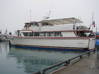
We continued on the Alaska Highway to Haines Junction where we picked up the Haines Highway. We stopped at an overlook of the Kluane Range. We are so happy to have a nice sunny day with clear blue skies for a change. We crossed into British Columbia and stopped for lunch on Chilkat Pass. We crossed the border back into the US at Dalton Cache and arrived in Haines. The Haines Highway had a lot of construction and long stretches of dirt road. They were putting water on the road to keep the construction dust down so now our truck and 5th wheel are really dirty. We are camped at Haines Hitch-up RV Park. We met with Ivanca, a young girl who is going to dog sit for us while we take a 12 hour wildlife and sightseeing cruise to Juneau on Saturday. When we got to Haines this afternoon we saw a large cruise ship in the harbor and Ivanca told us it was a “World Ship”. This is a ship that people live on permanently travel all over the world. We wanted to get a picture of it but Ivanca said it was

July 29, 2009

Image
We started off today (our 20th wedding anniversary) with breakfast at the campground café – sourdough pancakes, biscuits and gravy, reindeer sausage and pork sausage, and fruit – Mmmm good. The kid that ran the pancake toss last night was doing the cooking. We headed out on the Alaska Highway and crossed the border into Yukon, Canada at Port Alcan. We stopped at an overlook with a view of the St. Elias Mountains. We stopped at Congdon Creek Campground, a Yukon government campground on the Kluane Lake. After dinner we took the dogs on a nature trail hike and walked along the shore of the lake. Kluane lake is the largest lake in the Yukon and is a beautiful glacier fed lake. This trip has been a wonderful way to celebrate our 20 years of marriage!

July 28, 2009

Image
We left Valdez this morning in rain and fog and retraced our route back up the Richardson Highway. We ran out of the fog and rain after we went over Thompson Pass and thought we would be able to see more of the scenery. Not to be, shortly we ran into more smoke. We stopped at the visitor center at Wrangell-St. Elias National Park but it was really smoky so we didn’t stay very long. The ranger there (we think he was a ranger but he looked about 15 years old!) told us that there are currently 60 fires in Alaska and the smoke here is from the fires North of here around Fairbanks. Wrangell-St. Elias National Park is the largest national park in the US at 13.2 million acres. There are only 2 short gravel roads in the park so access is limited to backpacking, hiking and flight seeing. The park is mainly wilderness and has 4 major mountain ranges in it and includes 9 of the 16 highest peaks in the US. Unfortunately, because of the smoke we were not able to see any of them. We turned off the R

July 27, 2009

Image
We went on a cruise of Prince William Sound aboard the Glacier Spirit. It was so foggy and rainy that the captain had to sound his fog horn going out of the port. We saw a group of 7 sea otters shortly after we started. We were surprised to see so many jellyfish throughout the cruise. We had Dall’s porpoises alongside the boat a number of times. It was fun to see them zipping around the boat but it was hard to get a picture (notice the raindrops on the lens, it was a job trying to keep the camera dry). We saw a lot of Steller Sea Lions on rocks, buoys and swimming. Best of all, we got to see 5 humpback whales – it was fantastic! We went into Columbia Bay towards Columbia Glacier but were not able to get to the glacier because there was too much ice – we had to stop 6 miles away from the glacier. We did get some great pictures of the ice. The scenery was beautiful and the fog made for some very interesting pictures. We saw so many waterfalls we lost count. It was a wonderful cr

July 26, 2009

We visited the Valdez Museum which has a nice display arranged in a timeline starting with the earliest settlement to the present. We watched a film about the construction of the Alyeska Pipeline and one on the 1964 earthquake. The museum annex a few blocks away has a scaled diorama of old Valdez (before the earthquake). We watched another film about the earthquake that was narrated by survivors. There was footage filmed during the earthquake from a ship in harbor and footage the next morning. The destruction was amazing to see. It rained all night last night and was raining and misty all day today. The temperature the past week has not gotten above the low 60’s - we are getting anxious for a nice warm sunny day.

July 25, 2009

Image
We drove to “Old Valdez” about 4 miles from current Valdez. The 1964 earthquake totally destroyed the harbor at Old Valdez and did a lot of damage to the town. The town was moved to more stable ground. We stopped at the Crooked Creek Salmon Spawning Viewing Area where we watched pink and chum salmon spawning in Crooked Creek. We drove the Dayville Road – a short scenic road along Valdez Bay. Where Solomon Gulch Creek empties into Valdez Bay we could see so many pink and silver salmon that the water was churning with them. These salmon were much bigger than the ones we saw at Crooked Creek. This is a good spot to view bears, eagles, seals and sea lions feeding on the salmon. We watched a sea lion feeding a short distance from the shore but no bears. We also saw a number of sea otters playing. This road ends at the Alyeska Pipeline Terminal and we watched an oil tanker come up the bay and dock at the terminal.

July 24, 2009

Image
We headed back down the Glenn Highway this morning. The road follows the Matanuska River and the scenery is beautiful (just like all the places we have been). We actually saw the sun for a little while this morning! We stopped at Matanuska Glacier State Recreational Site and hiked a trail to an overlook of the glacier. This glacier is 27 miles long and averages 2 miles wide but is 4 miles wide at the end. We turned onto the Richardson Highway at Glenallen and headed south to Valdez. We drove past Wrangell-St. Elia National Park but will stop there on our way back. We stopped at Worthington Glacier and walked a short path to an overlook. We drove over Thompson Pass and headed down to Valdez – this is a beautiful area with lots of waterfalls. We stopped at Bridal Veil Falls and Horsetail Falls. It started raining again just before we reached Valdez. We are staying at Eagle Rest RV Park in Valdez, just a couple blocks from the harbor.

July 23, 2009

Image
We went to a musk ox farm outside of Palmer – a non-profit farm established to provide musk ox fiber (qiviut) to Native people in remote Alaskan villages. The women from these villages knit beautiful qiviut items by hand to supplement their subsistence lifestyle. Qiviut is 8 times warmer than sheep’s wool, does not itch, and does not shrink. It is a very rare fiber and the knitted items are very expensive. A few miles up the road we stopped at the Alpine Historical Park in Sutton. In 1920 the US Navy appropriated one million dollars for development of the Wishbone Hill Coal Mining District. This included the construction of the massive coal washery located at the site of the park. The washery cleaned the coal mined in the area. By 1925 the Navy determined that the coal was deficient and shut down the mine and washery. The washery, which cost $400,000 to build, only operated 6 months. There was also displays on the Native people and on the building of the Glenn Highway.

July 22, 2009

Image
Still raining… we left Seward and retraced our route back up the Seward Highway to Anchorage and picked up the Glenn Highway to Palmer. As it was raining and overcast we did not see any more going back up the Seward Highway than we saw coming down. We got to Palmer around noon and are camping at the Matanuska-River Park. This is a Borough park (like a county park) and is really nice – grassy and trees. Palmer is in the Matanuska Valley, which is an agricultural area, and is very lush and green. We drove up Hatcher Pass Road to the Independence Mine State Historical Park. It was a beautiful drive up a very green valley with lots of wild flowers. The Independence Mine was a gold mine that operated from 1938 through 1941. Some of the buildings are nicely restored and some are not. We saw some wildlife along the way but he ignored us – Rex whistled at him and he didn’t move until we drove on.

July 21, 2009

Image
It is raining hard today so we are glad we planned to visit the Alaska SeaLife Center. This is a research and rescue facility for marine life. They have many very large tanks displaying the various marine life in Alaska. We saw Steller sea lions, harbor seals, a rescued sea otter along with all kinds of fish and birds. We took a marine mammal encounter tour where we went into the research/rescue area. Our guide told us about the rescue and research work being done. We were able to see 3 harbor seals and 1 Steller sea lion close up with a trainer. He showed us how they train the seals and sea lions so they can handle them and do medical exams and treatments safely. We were allowed to feed Addie, a timid female harbor seal they are trying to get accustomed to humans. This is a great facility and we enjoyed seeing and learning about all the marine life in Alaska. We visited the Seward Museum, a very nice small museum that has a lot of displays about Seward history. They have a pictori